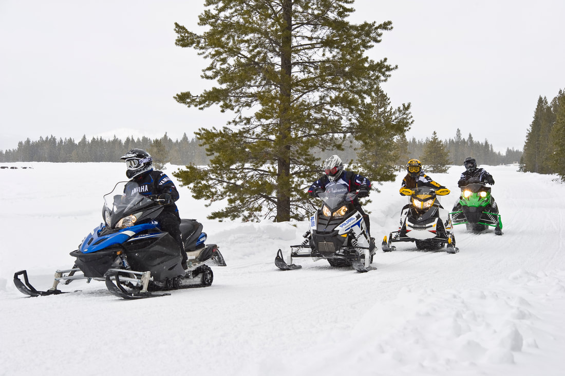
Trails & Conditions
See links to info below to latest conditions for Marathon County / Wausau / Central Wisconsin area snowmobile trails. Are YOU a member of a local snowmobile club to help support area trails and responsible riding? If not a member, we welcome you to Join Trailmates Snowmobile Club online. Thank You for your generous support! We hope you enjoy your travels throughout Wausau / Central Wisconsin. Be sure to check out other events that may be of interest too.
In Marathon County, Wisconsin there are:
|
MILES OF SNOWMOBILE TRAILS
|
TRAIL GROOMERS
|
SNOWMOBILE CLUBS
|
|
FOR THE LATEST MARATHON COUNTY, WI SNOWMOBILE TRAIL INFO INCLUDING OPENINGS, CLOSURES & EXCEPTIONS: http://www.co.marathon.wi.us/departments/parksrecreationforestry/recreationopportunities/snowmobiling.aspx THANK YOU to all area landowners, businesses & organizations who allow trails to travel across their lands in connecting more than 25,000 miles of Wisconsin trails to explore each season by snowmobile.
|
Current / Upcoming WeatherLocal & Regional Forecasts
|

ATV WINTER USE NOTICE: ATVs are prohibited on ANY winter trail in Marathon County when the air temperature is ABOVE 28°F. Use of ATVs is ONLY where allowed / specified in Marathon County per the current trail map posted below AND when temperatures are BELOW 28°F to protect the lands. Additionally, ATV use may be LIMITED or RESTRICTED during some trail openings/periods of warm weather so check this page for updated information prior to riding. No ATVs (or UTVs) can be operated on the Mountain Bay Trail AT ANY TIME, during ANY SEASON. Do not ride on CLOSED or NON-DESIGNATED trails; Familiarize yourself with the the current map which lists all snowmobile trails & also those trails designated specifically for ATV operation.
UTVs ARE PROHIBITED ON ALL MARATHON COUNTY TRAILS: ALL Marathon County trails are CLOSED to UTVs (side by side vehicles). For information on use of UTVs & ATVs in other Wisconsin counties and where to ride specifically, see the WATVA Wisconsin ATV/UTV Trail Planning Map.
|
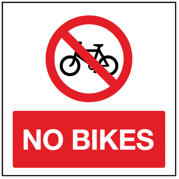
NOTICE: NO bicycles of ANY type, including "fat bikes/snow bikes," allowed on ANY Marathon County snowmobile or ATV trail(s). No motorized "snow bike" KIT or conversion-type vehicles are legal for operation in Wisconsin including, but not limited to, dirt bike and/or motorcycle conversions such as "Timbersled" and others. |
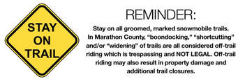
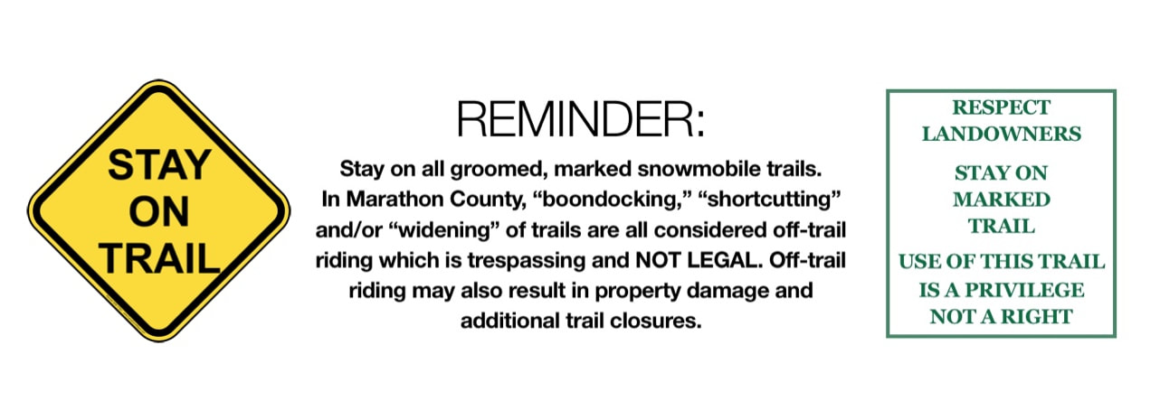
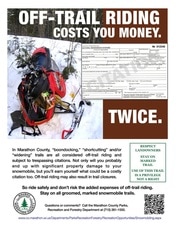
Off-Trail Riding = TRESPASSING
|
In Marathon County, "boondocking," "shortcutting" and/or "widening" trails are all PROHIBITED; They are considered off-trail riding and subject to trespassing citations. Not only will you probably end up with significant property damage to your snowmobile, but you'll earn yourself what could be a costly citation too. Off-trail riding may also result in trail closures. So don't make it a costly ride; Know BEFORE you go and obey all applicable laws.
Ride safely and don't risk the added expenses of off-trail riding. Stay on all groomed, marked trails.
|
|
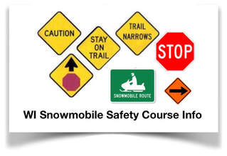
Snowmobile Safety Certificate Notice/Course Info: All riders at least age 12 and born on or after January 1, 1985, are required to obtain and carry a valid snowmobile safety certificate. To locate/enroll in a Wisconsin DNR-certified snowmobile safety course to obtain the valid safety certificate to ride, just search the Wisconsin DNR 'Go Wild' website where you'll find all the latest, confirmed courses with registration and contact information updated there (as available/announced) for each. We encourage ALL riders to review the Wisconsin DNR safety tips, snowmobile registration information official regulations at the Wisconsin DNR website before riding. |
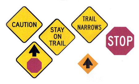
Know Before You Go:
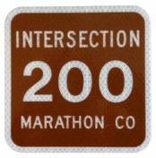
This Little Brown Sign Could Save Your Life.
This Little Brown Sign Could Save Your Life.
|
Marathon County Snowmobile Clubs have placed brown, 3 digit number signs throughout the County at key intersections. In the event of an emergency, the 911 dispatcher will ask you for this number. Their emergency response system can identify these numbers & give important information to rescue personnel.
Pay attention to intersection number signs. They can save lives.
|
Planning a Ride in or around Wausau / Central Wisconsin?
You can find more than 25 area Park & Ride locations on our trail map to access snowmobile trails, get Wisconsin Snowmobile Trail Pass info or find the best area on-trail lodging as recommended by riders here as below. We hope you enjoy your travels throughout the Wausau / Central Wisconsin area.

There are over 25 designated Park & Ride snowmobile locations in Marathon County with trailer parking to access 850+ miles of groomed trails. More... |
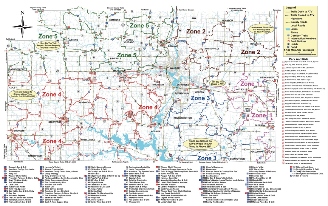
There are 850+ miles of snowmobile trails to enjoy in the Wausau / Central Wisconsin area. View map... |